



Best Selling
 Grid
 List

Garmin AMPS Rugged Mount with Power/Audio Cable
Take advantage of Montana's versatility. Mount your Montana on your motorcycle or ATV and take it on the road. This kit includes the mount, hardware (AMPS arm/ball socket sold separately) and a cable with bare power/audio/data wires. It also includes anti-glare screen protectors.

Garmin Anti-glare Screen Protectors for GPSMAP 276Cx
These screen protectors reduce sunlight glare, minimize fingerprint smudges and protect against scratches. Includes 3 per package.

Garmin Anti-glare Screen Protectors for Montana Series
These screen protectors reduce sunlight glare on the Montana's display, minimize fingerprint smudges and protect against scratches. Includes 3 per package.
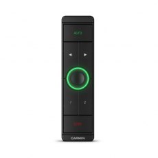
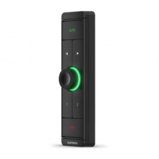

Garmin APK 10 Autopilot Keypad
Get easy-to-use control of any Reactor 40 autopilot, with intuitive knob and button activation, for easy heading changes and more.

Garmin Auto Friction Mount Kit with Speaker
Keep your compatible outdoor device in view as you drive with this portable dashboard mount. Includes friction mount with integrated speaker and power cable.

Garmin Auto Mount for GPSMAP 78
Clip your compatible device into our auto mount to swivel or tilt for optimal viewing while driving. And simply take it out when you're ready to go. The mount attaches to your dashboard using the included adhesive disc.

Garmin Autopilot ECU for GHP 12 Autopilots
One of five main components of your GHP ™ 12 Autopilot System, the ECU connects and powers the course computer unit (CCU) and the hydraulic pump, controlling the pump based on information received from the CCU.

Garmin Autopilot ECU to CCU Extension Cable - 25m
Garmin ECU to CCU Extension Cable with Quarter-turn collar - 25m.

Garmin Autopilot ECU to CCU Extension Cable - 5m
Garmin ECU to CCU Extension Cable with Quarter-turn collar - 5m.

Garmin Autopilot SmartPump v2
Put an end to guessing which pump size will work with any particular boat. One SmartPump v2 works for most hydraulically steered boats and applications.

Garmin B175M 20° Tilt 8 Pin Bronze Thru-Hull Transducer
Step up to 1 kW without a fairing with this flush-mounted bronze housing that protrudes less than 1/4-inch outside the hull and can sit on the trailer rollers/bunks without damage. The tilted element inside the transducer accommodates all hull deadrises and eliminates the need for a fairing block. And, low, medium and high frequency versions provide maximum flexibility for the choice of frequencies.

Garmin B75M 20° Tilt 8 Pin Bronze Thru-Hull Transducer
A 600 W transducer with 8 pins, it has a depth of 900 ft; an operating frequency of 80-130 kHz; a beamwidth of 24/16 degrees; and a 16 to 24 degree deadrise. Transducer kit comes with installation instructions. Follow the instructions carefully to avoid damaging your boat.

Garmin Bail Mount for EchoMAP 72/75/92/95
Surface mount your ECHOMAP™ using our bail mount with knobs; the mount tilts for optimum viewing. With the mount’s quick cable disconnect feature, you can plug the necessary cords into the mount, allowing you to seat/unseat your device with ease.

Garmin Bail Mount for GPSMAP 7407/7607
Surface mount your GPSMAP using our bail mount with knobs. The mount tilts for optimum viewing.

Garmin Bail Mount for GPSMAP 7416/7616
Surface mount your GPSMAP using our bail mount with knobs. The mount swivels and tilts for optimum viewing.

Garmin Bail Mount with Knobs (GPSMAP 1000 Series)
Surface mount your GPSMAP using this bail mount with knobs. The mount swivels and tilts for optimum viewing.

Garmin Bail Mount with Knobs (GPSMAP 12x2 Series)
Surface mount your compatible GPSMAP using our bail mount with knobs. The mount tilts for optimum viewing.

Garmin Bail Mount with Knobs (GPSMAP9x2 Series)
Surface mount your compatible GPSMAP using our bail mount with knobs. The mount tilts for optimum viewing.

Garmin Bail Mount with Knobs GPSMAP 7410 / 7610
Surface mount your GPSMAP using this bail mount with knobs. The mount tilts for optimum viewing.

Garmin Bail Mount with Quick Release Cradle - EchoMAP CHIRP 75sv/92/95
Surface mount your compatible ECHOMAP™ chartplotter/sounder combo using our bail mount with knobs; the mount tilts for optimum viewing. With the mount’s quick cable disconnect feature, you can plug the necessary cords into the mount, allowing you to seat/unseat your device with ease.


Garmin Bail Mount With Quick Release Cradle For Echomap Ultra2 102sv
Surface mount a compatible ECHOMAP Ultra 2 chartplotter by using this bail mount with knobs; the mount tilts for optimum viewing. Plugging the cables into the mount’s quick-release cradle allows users to quickly seat/unseat the device with ease.


Garmin Bail Mount With Quick Release Cradle For Echomap Ultra2 122sv
Surface mount a compatible ECHOMAP Ultra 2 chartplotter by using this bail mount with knobs; the mount tilts for optimum viewing. Plugging the cables into the mount’s quick-release cradle allows users to quickly seat/unseat the device with ease.

Garmin Bail Trunnion Mount & Quick Release Cradle for ECHOMAP Ultra 122
Surface mount your compatible ECHOMAP™ Ultra chartplotter/sounder combo using our bail mount with knobs; the mount tilts for optimum viewing. Plugging the cables into the mount’s quick-release cradle allows you to seat/unseat your device with ease.

Garmin Bail Trunnion Mount For GPSMAP 10x2 Series
Surface mount any compatible GPSMAP using our bail mount with knobs. The mount tilts for optimum viewing.

Garmin Bail Trunnion Mount for GPSMAP 1223
Surface mount your compatible GPSMAP device using our bail mount with knobs. The mount tilts for optimum viewing.

Garmin Bail Trunnion Mount for GPSMAP 12x2 Touch / 7x2 Series
Surface mount a Compatible GPSMAP using this bail mount with knobs. The mount tilts for optimum viewing.

Garmin Bail Trunnion Mount for GPSMAP 4008
Replacement Bail Mount for GPSMAP 4008 Weight: 249 gSize: 31 x 13.5 x 2.5 cm

Garmin Bail Trunnion Mount inc Knobs (GPSMAP 7x2 Series)
Surface mount your compatible GPSMAP using our bail mount with knobs. The mount tilts for optimum viewing.

Garmin Bail Trunnion Mount with Quick Release Cradle for EchoMAP CHIRP 75dv
Surface mount your compatible ECHOMAP™ chartplotter/sounder combo using our bail mount with knobs; the mount tilts for optimum viewing. With the mount’s quick cable disconnect feature, you can plug the necessary cords into the mount, allowing you to seat/unseat your device with ease.

Garmin Blue Chart G3 Vision Large Area - VEU721L Northern Europe
Experience unparalleled coverage and brilliant detail when you're on the water. BlueChart G3 Vision coastal charts provide industry-leading coverage, clarity and detail with integrated Garmin and Navionics content. Compatible with the Garmin GPSMAP and ECHOMAP series Chartplotters.
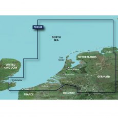
Garmin BlueChart G3 - HXEU018R: Benelux Offshore & Inland Waters
BlueChart g3 coastal charts provide industry-leading coverage, clarity and detail with integrated Garmin and Navionics data. Also included is Auto Guidance technology, which uses your desired depth and overhead clearance to calculate routes and provide a suggested path to follow — overlaid onto your chart. NOAA raster cartography is also available as a free downloadable feature via the ActiveCaptain app. It gives your chartplotter paper chartlike views of NOAA-surveyed areas in which individual points of interest are labelled with corresponding longitude and latitude information. Worldwide coverage is available by regions as accessory cards or via download; each region is sold separately. Compatable with ECHOMAP™ Plus series chartplotters.
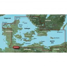
Garmin BlueChart G3 - HXEU021R: Denmark East & Sweden Southeast
BlueChart g3 coastal charts provide industry-leading coverage, clarity and detail with integrated Garmin and Navionics data. Also included is Auto Guidance technology, which uses your desired depth and overhead clearance to calculate routes and provide a suggested path to follow — overlaid onto your chart. NOAA raster cartography is also available as a free downloadable feature via the ActiveCaptain app. It gives your chartplotter paper chartlike views of NOAA-surveyed areas in which individual points of interest are labelled with corresponding longitude and latitude information. Worldwide coverage is available by regions as accessory cards or via download; each region is sold separately. Compatable with ECHOMAP™ Plus series chartplotters.
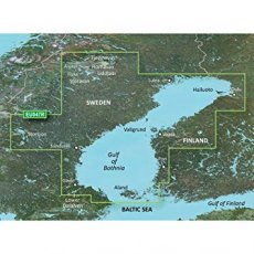
Garmin BlueChart G3 - HXEU047R: Gulf of Bothnia
BlueChart g3 coastal charts provide industry-leading coverage, clarity and detail with integrated Garmin and Navionics data. Also included is Auto Guidance technology, which uses your desired depth and overhead clearance to calculate routes and provide a suggested path to follow — overlaid onto your chart. NOAA raster cartography is also available as a free downloadable feature via the ActiveCaptain app. It gives your chartplotter paper chartlike views of NOAA-surveyed areas in which individual points of interest are labelled with corresponding longitude and latitude information. Worldwide coverage is available by regions as accessory cards or via download; each region is sold separately. Compatable with ECHOMAP™ Plus series chartplotters.

Garmin BlueChart G3 - HXEU065R: Baltic Sea, East Coast
BlueChart g3 coastal charts provide industry-leading coverage, clarity and detail with integrated Garmin and Navionics data. Also included is Auto Guidance technology, which uses your desired depth and overhead clearance to calculate routes and provide a suggested path to follow — overlaid onto your chart. NOAA raster cartography is also available as a free downloadable feature via the ActiveCaptain app. It gives your chartplotter paper chartlike views of NOAA-surveyed areas in which individual points of interest are labelled with corresponding longitude and latitude information. Worldwide coverage is available by regions as accessory cards or via download; each region is sold separately. Compatable with ECHOMAP™ Plus series chartplotters.

Garmin BlueChart G3 Regular Area - HXEU001R English Channel
BlueChart g3 coastal charts provide industry-leading coverage, clarity and detail with integrated Garmin and Navionics data. Also included is Auto Guidance technology, which uses your desired depth and overhead clearance to calculate routes and provide a suggested path to follow — overlaid onto your chart. NOAA raster cartography is also available as a free downloadable feature via the ActiveCaptain app. It gives your chartplotter paper chartlike views of NOAA-surveyed areas in which individual points of interest are labelled with corresponding longitude and latitude information. Worldwide coverage is available by regions as accessory cards or via download; each region is sold separately. Compatable with ECHOMAP™ Plus series chartplotters.

Garmin BlueChart G3 Regular Area - HXEU004R Irish Sea
BlueChart g3 coastal charts provide industry-leading coverage, clarity and detail with integrated Garmin and Navionics data. Also included is Auto Guidance technology, which uses your desired depth and overhead clearance to calculate routes and provide a suggested path to follow — overlaid onto your chart. NOAA raster cartography is also available as a free downloadable feature via the ActiveCaptain app. It gives your chartplotter paper chartlike views of NOAA-surveyed areas in which individual points of interest are labelled with corresponding longitude and latitude information. Worldwide coverage is available by regions as accessory cards or via download; each region is sold separately. Compatable with ECHOMAP™ Plus series chartplotters.

Garmin BlueChart G3 Regular Area - HXEU005R Ireland, West Coast
BlueChart g3 coastal charts provide industry-leading coverage, clarity and detail with integrated Garmin and Navionics data. Also included is Auto Guidance technology, which uses your desired depth and overhead clearance to calculate routes and provide a suggested path to follow — overlaid onto your chart. NOAA raster cartography is also available as a free downloadable feature via the ActiveCaptain app. It gives your chartplotter paper chartlike views of NOAA-surveyed areas in which individual points of interest are labelled with corresponding longitude and latitude information. Worldwide coverage is available by regions as accessory cards or via download; each region is sold separately. Compatable with ECHOMAP™ Plus series chartplotters.

Garmin BlueChart G3 Regular Area - HXEU006R Scotland, West Coast
BlueChart g3 coastal charts provide industry-leading coverage, clarity and detail with integrated Garmin and Navionics data. Also included is Auto Guidance technology, which uses your desired depth and overhead clearance to calculate routes and provide a suggested path to follow — overlaid onto your chart. NOAA raster cartography is also available as a free downloadable feature via the ActiveCaptain app. It gives your chartplotter paper chartlike views of NOAA-surveyed areas in which individual points of interest are labelled with corresponding longitude and latitude information. Worldwide coverage is available by regions as accessory cards or via download; each region is sold separately. Compatable with ECHOMAP™ Plus series chartplotters.

Garmin BlueChart G3 Regular Area - HXEU009R Portugal & Northwest Spain
BlueChart g3 coastal charts provide industry-leading coverage, clarity and detail with integrated Garmin and Navionics data. Also included is Auto Guidance technology, which uses your desired depth and overhead clearance to calculate routes and provide a suggested path to follow — overlaid onto your chart. NOAA raster cartography is also available as a free downloadable feature via the ActiveCaptain app. It gives your chartplotter paper chartlike views of NOAA-surveyed areas in which individual points of interest are labelled with corresponding longitude and latitude information. Worldwide coverage is available by regions as accessory cards or via download; each region is sold separately. Compatable with ECHOMAP™ Plus series chartplotters.

Garmin BlueChart G3 Regular Area - HXEU013R Italy Southwest & Tunisia
BlueChart g3 coastal charts provide industry-leading coverage, clarity and detail with integrated Garmin and Navionics data. Also included is Auto Guidance technology, which uses your desired depth and overhead clearance to calculate routes and provide a suggested path to follow — overlaid onto your chart. NOAA raster cartography is also available as a free downloadable feature via the ActiveCaptain app. It gives your chartplotter paper chartlike views of NOAA-surveyed areas in which individual points of interest are labelled with corresponding longitude and latitude information. Worldwide coverage is available by regions as accessory cards or via download; each region is sold separately. Compatable with ECHOMAP™ Plus series chartplotters.

Garmin BlueChart G3 Regular Area - HXEU014R Italy, Adriatic Sea
BlueChart g3 coastal charts provide industry-leading coverage, clarity and detail with integrated Garmin and Navionics data. Also included is Auto Guidance technology, which uses your desired depth and overhead clearance to calculate routes and provide a suggested path to follow — overlaid onto your chart. NOAA raster cartography is also available as a free downloadable feature via the ActiveCaptain app. It gives your chartplotter paper chartlike views of NOAA-surveyed areas in which individual points of interest are labelled with corresponding longitude and latitude information. Worldwide coverage is available by regions as accessory cards or via download; each region is sold separately. Compatable with ECHOMAP™ Plus series chartplotters.

Garmin BlueChart G3 Regular Area - HXEU016R Mediterranean Southeast
BlueChart g3 coastal charts provide industry-leading coverage, clarity and detail with integrated Garmin and Navionics data. Also included is Auto Guidance technology, which uses your desired depth and overhead clearance to calculate routes and provide a suggested path to follow — overlaid onto your chart. NOAA raster cartography is also available as a free downloadable feature via the ActiveCaptain app. It gives your chartplotter paper chartlike views of NOAA-surveyed areas in which individual points of interest are labelled with corresponding longitude and latitude information. Worldwide coverage is available by regions as accessory cards or via download; each region is sold separately. Compatable with ECHOMAP™ Plus series chartplotters.

Garmin BlueChart G3 Regular Area - HXEU019R Alborg-Amsterdam
BlueChart g3 coastal charts provide industry-leading coverage, clarity and detail with integrated Garmin and Navionics data. Also included is Auto Guidance technology, which uses your desired depth and overhead clearance to calculate routes and provide a suggested path to follow — overlaid onto your chart. NOAA raster cartography is also available as a free downloadable feature via the ActiveCaptain app. It gives your chartplotter paper chartlike views of NOAA-surveyed areas in which individual points of interest are labelled with corresponding longitude and latitude information. Worldwide coverage is available by regions as accessory cards or via download; each region is sold separately. Compatable with ECHOMAP™ Plus series chartplotters.

Garmin BlueChart G3 Regular Area - HXEU041R Oslo-Skagerak-Haugesund
BlueChart g3 coastal charts provide industry-leading coverage, clarity and detail with integrated Garmin and Navionics data. Also included is Auto Guidance technology, which uses your desired depth and overhead clearance to calculate routes and provide a suggested path to follow — overlaid onto your chart. NOAA raster cartography is also available as a free downloadable feature via the ActiveCaptain app. It gives your chartplotter paper chartlike views of NOAA-surveyed areas in which individual points of interest are labelled with corresponding longitude and latitude information. Worldwide coverage is available by regions as accessory cards or via download; each region is sold separately. Compatable with ECHOMAP™ Plus series chartplotters.

Garmin BlueChart G3 Regular Area - HXEU042R Oslo-Trelleborg
BlueChart g3 coastal charts provide industry-leading coverage, clarity and detail with integrated Garmin and Navionics data. Also included is Auto Guidance technology, which uses your desired depth and overhead clearance to calculate routes and provide a suggested path to follow — overlaid onto your chart. NOAA raster cartography is also available as a free downloadable feature via the ActiveCaptain app. It gives your chartplotter paper chartlike views of NOAA-surveyed areas in which individual points of interest are labelled with corresponding longitude and latitude information. Worldwide coverage is available by regions as accessory cards or via download; each region is sold separately. Compatable with ECHOMAP™ Plus series chartplotters.

Garmin BlueChart G3 Regular Area - HXEU043R Iceland to Orkney
BlueChart g3 coastal charts provide industry-leading coverage, clarity and detail with integrated Garmin and Navionics data. Also included is Auto Guidance technology, which uses your desired depth and overhead clearance to calculate routes and provide a suggested path to follow — overlaid onto your chart. NOAA raster cartography is also available as a free downloadable feature via the ActiveCaptain app. It gives your chartplotter paper chartlike views of NOAA-surveyed areas in which individual points of interest are labelled with corresponding longitude and latitude information. Worldwide coverage is available by regions as accessory cards or via download; each region is sold separately. Compatable with ECHOMAP™ Plus series chartplotters.

Garmin BlueChart G3 Regular Area - HXEU046R Sweden, South-East
BlueChart g3 coastal charts provide industry-leading coverage, clarity and detail with integrated Garmin and Navionics data. Also included is Auto Guidance technology, which uses your desired depth and overhead clearance to calculate routes and provide a suggested path to follow — overlaid onto your chart. NOAA raster cartography is also available as a free downloadable feature via the ActiveCaptain app. It gives your chartplotter paper chartlike views of NOAA-surveyed areas in which individual points of interest are labelled with corresponding longitude and latitude information. Worldwide coverage is available by regions as accessory cards or via download; each region is sold separately. Compatable with ECHOMAP™ Plus series chartplotters.

Garmin BlueChart G3 Regular Area - HXEU050R Gulfs of Finland & Riga
BlueChart g3 coastal charts provide industry-leading coverage, clarity and detail with integrated Garmin and Navionics data. Also included is Auto Guidance technology, which uses your desired depth and overhead clearance to calculate routes and provide a suggested path to follow — overlaid onto your chart. NOAA raster cartography is also available as a free downloadable feature via the ActiveCaptain app. It gives your chartplotter paper chartlike views of NOAA-surveyed areas in which individual points of interest are labelled with corresponding longitude and latitude information. Worldwide coverage is available by regions as accessory cards or via download; each region is sold separately. Compatable with ECHOMAP™ Plus series chartplotters.