
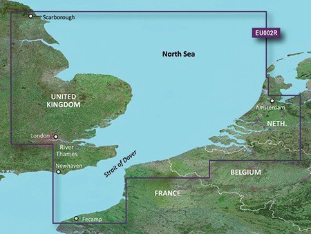
Garmin Bluechart G3 EU002R S/E England-Benelux Inland Waters


Product Description
EU002R Garmin Bluechart G3 S/E England-Benelux Inland WatersUnparalleled Coastal Chart Coverage
Provides industry-leading coverage, clarity and detail with updated coastal charts that feature integrated Garmin and Navionics data
Auto Guidance1 technology calculates a route using your desired depth and overhead clearance and provides a suggested path to follow
Includes Depth Range Shading for up to 10 depth ranges, enabling you to view your target depth at a glance
Up to 1-foot contours provide a more accurate depiction of the bottom structure for improved fishing charts and navigation in swamps, canals and marinas
Auto Guidance Technology
The Auto Guidance feature calculates a suggested route using your desired depth and overhead clearance.
Depth Range Shading
This feature displays high-resolution Depth Range Shading for up to 10 depth ranges, so you can view your designated target depth.
Detailed Contours
BlueChart g3 charts feature 1-foot contours that provide a more accurate depiction of bottom structure for improved fishing charts and enhanced detail in swamps, canals and port plans.
Shallow Water Shading
To aid in navigation, Shallow Water Shading allows map shading at a user-defined depth to give a clear picture of shallow waters to avoid.
Compatable with ECHOMAP™ Plus series Chartplotters.
## We are unable to offer an exchange or refund on incorrectly ordered charts ##
Collect in Store
This item is available for collection.
People who bought this also bought...